Torborg house in Orlando, updated 11/06/2003
|
|
|
|
|
|
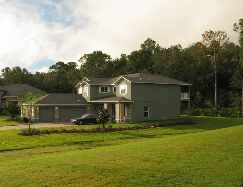
This is a picture of the house from Nov 4, 2003
|
|
|
The subdivision we are going into is part of a large development called Stoneybrook.
Our subdivision is Stewart's Cove. We are in lot #57. This map is incorrect about North.
Up is actually east by north east.
|

|
|
Click for larger image.
Immediately to the left of lot 57 is the 15th hole of the golf course. The tee is
to the upper left of the pond on the left. The entrance to the subdivision is also in the upper left.
The green dots indicate lots that were sold when this photo was taken in December.
|
|
|
|
Click for larger image -- This is US Homes' promotional
map of the entire Stoneybrook development. Our neighborhood is shown in orange just to the right of
middle of this image. A few pix down I have an aerial photo of Stoneybrook. Notice the
left-most subdivision, Stone Forest, that is sort of F shaped.
|

|
|
Click for larger image
|
|
|
|
This is a satellite view from Mapquest
showing how Stoneybrook fits into the surrounding terrain.
The white shapes to the left of the development are water treatment ponds apparently. I have never seen
them. At the bottom of the image on the left is a landfill and the bottom right is a coal fired power
plant. Off the image to the south is the Orange County Reception Center which is not a convention center
and is surrounded by high fences, razor wire and observation towers.
|

|
|
|
Property
|
This is a satellite image from early 2002 showing our neighborhood.
|

|
|
|
Click for larger image
This is an aerial photo from July 2002 showing the Stoneybrook development and some surrounding terrain.
The subdivision that is F shaped is in the right foreground. Our plot is indicated with the red arrow.
Notice the scenic coal fired power plant.
|

|
|


